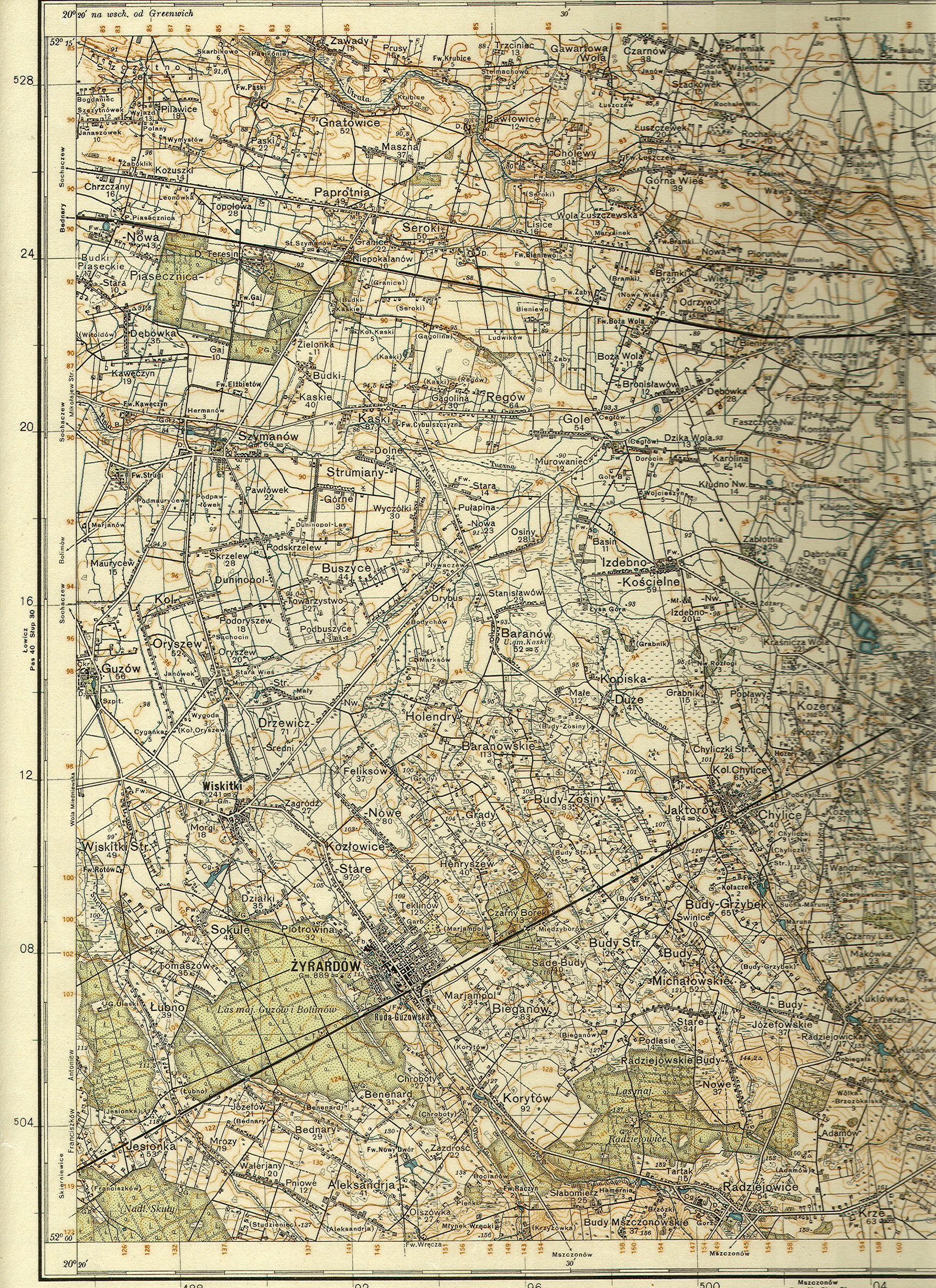
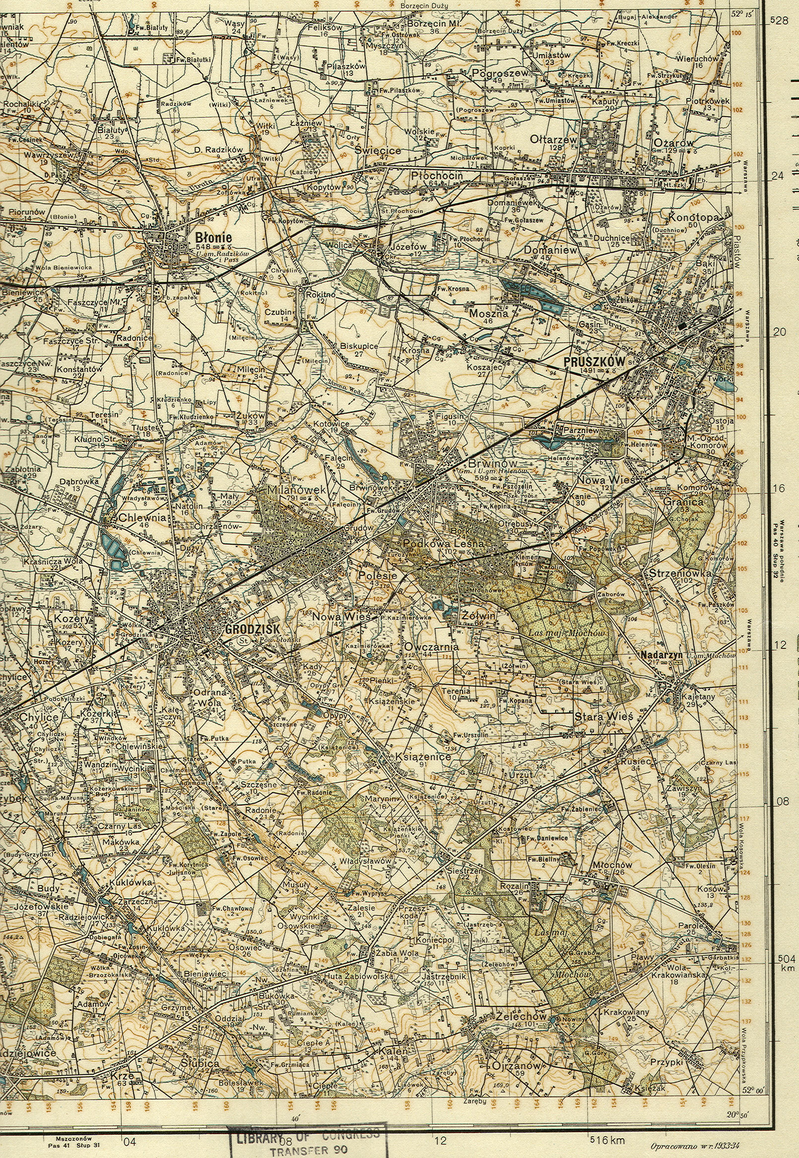
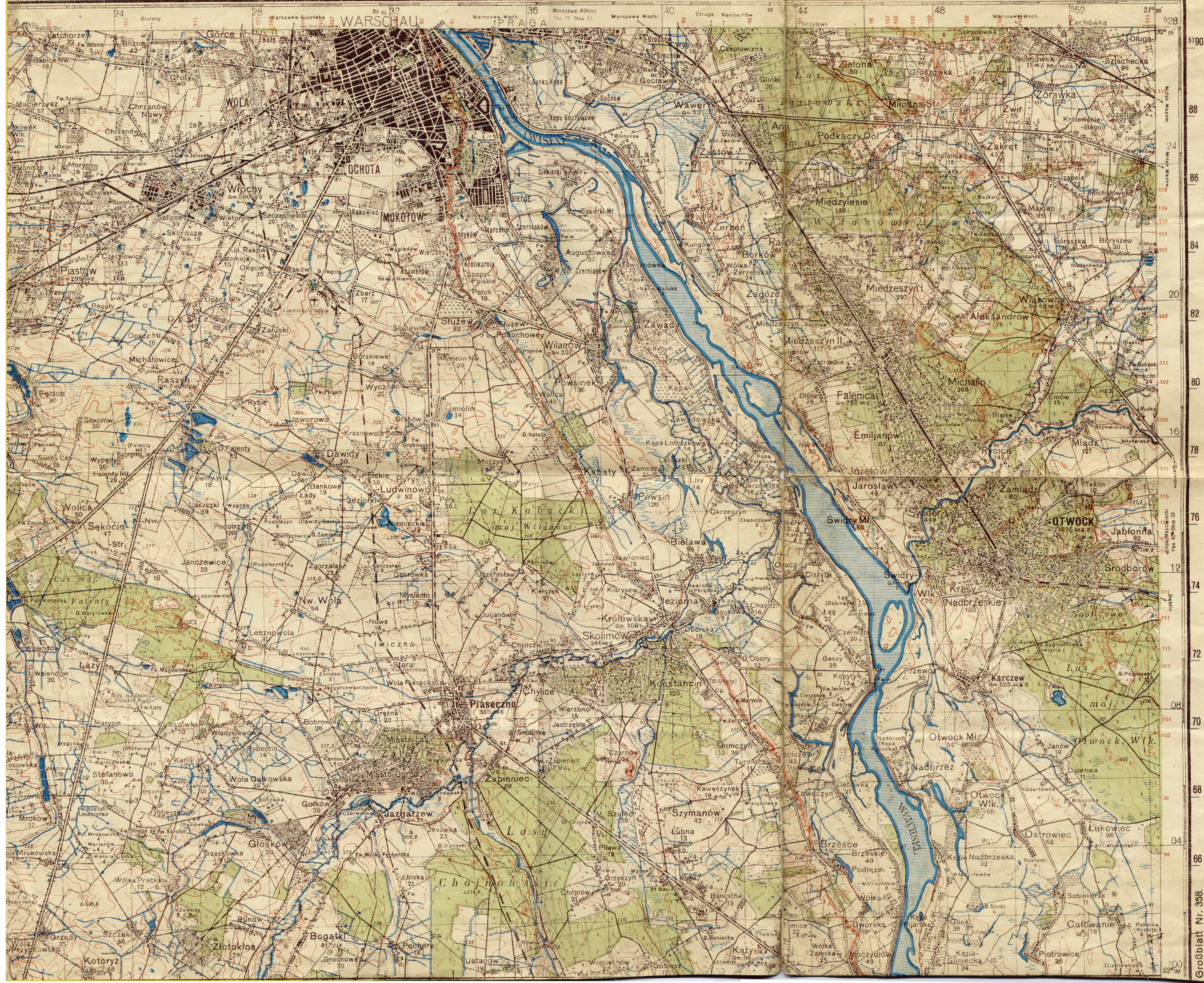
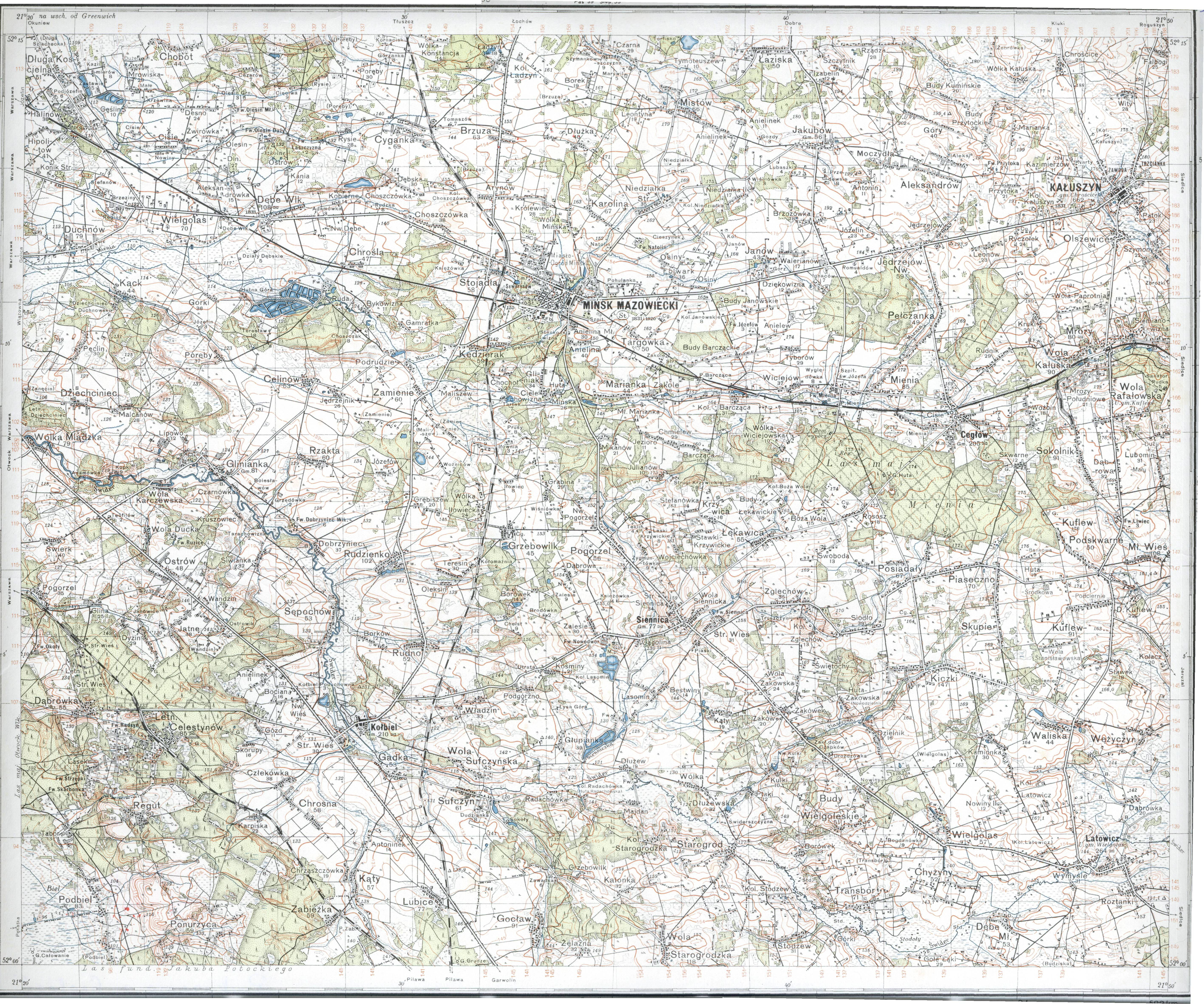
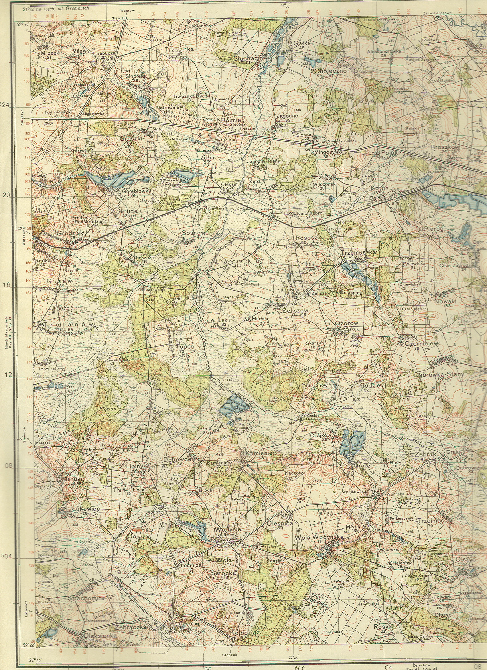
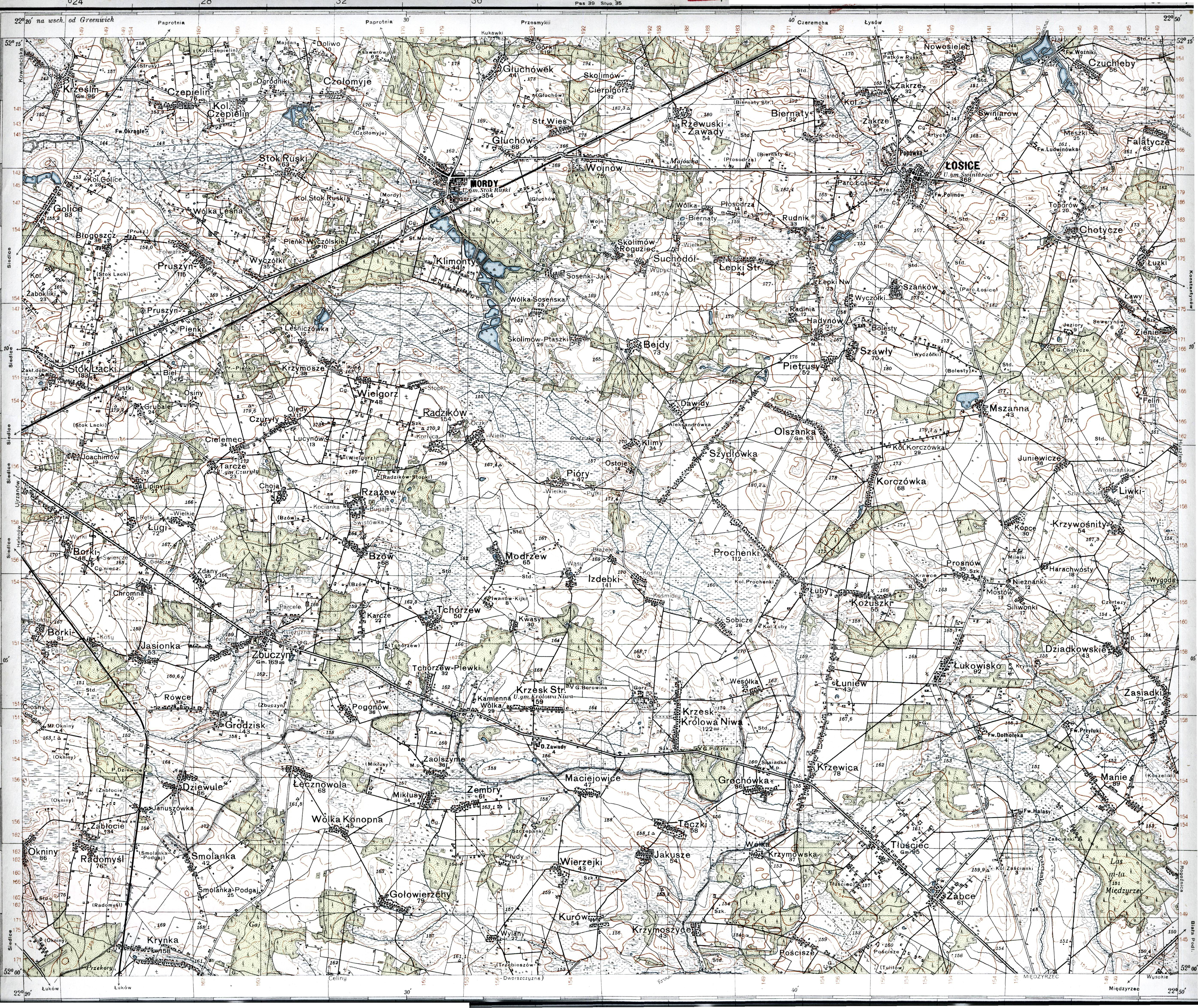
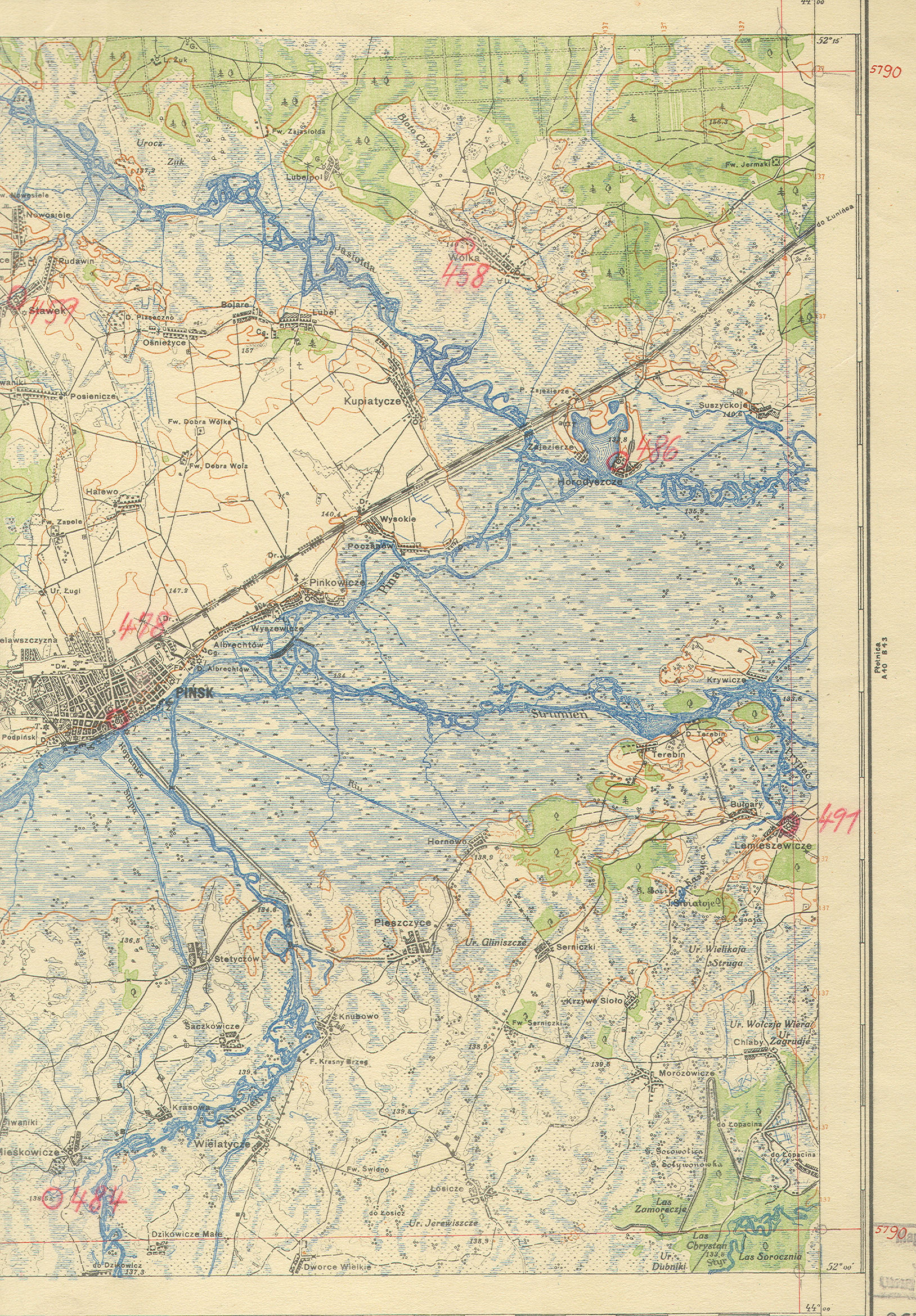
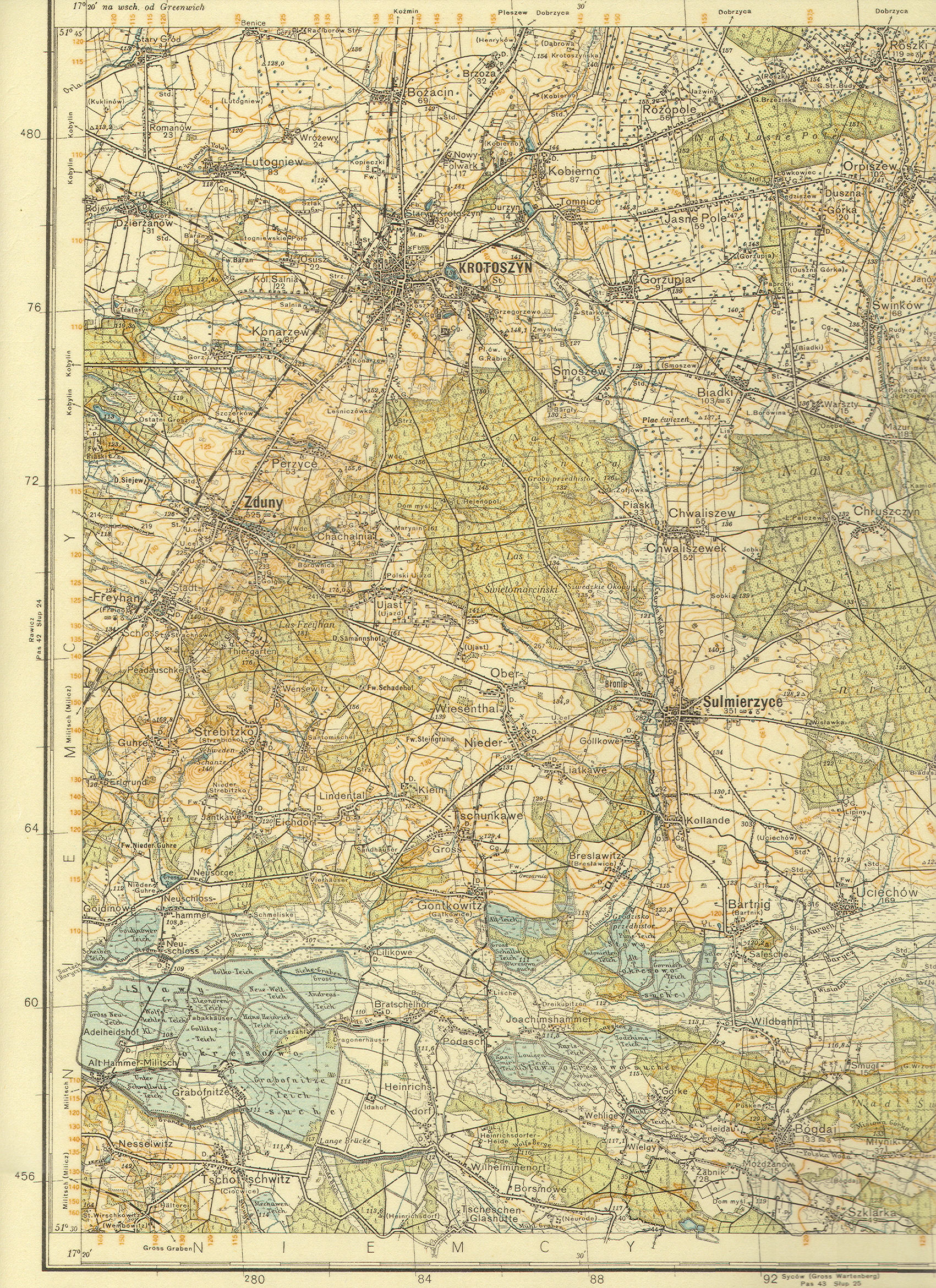
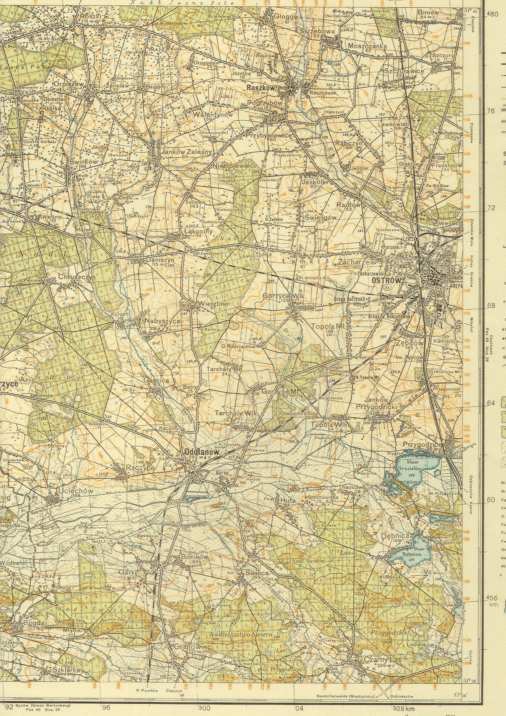
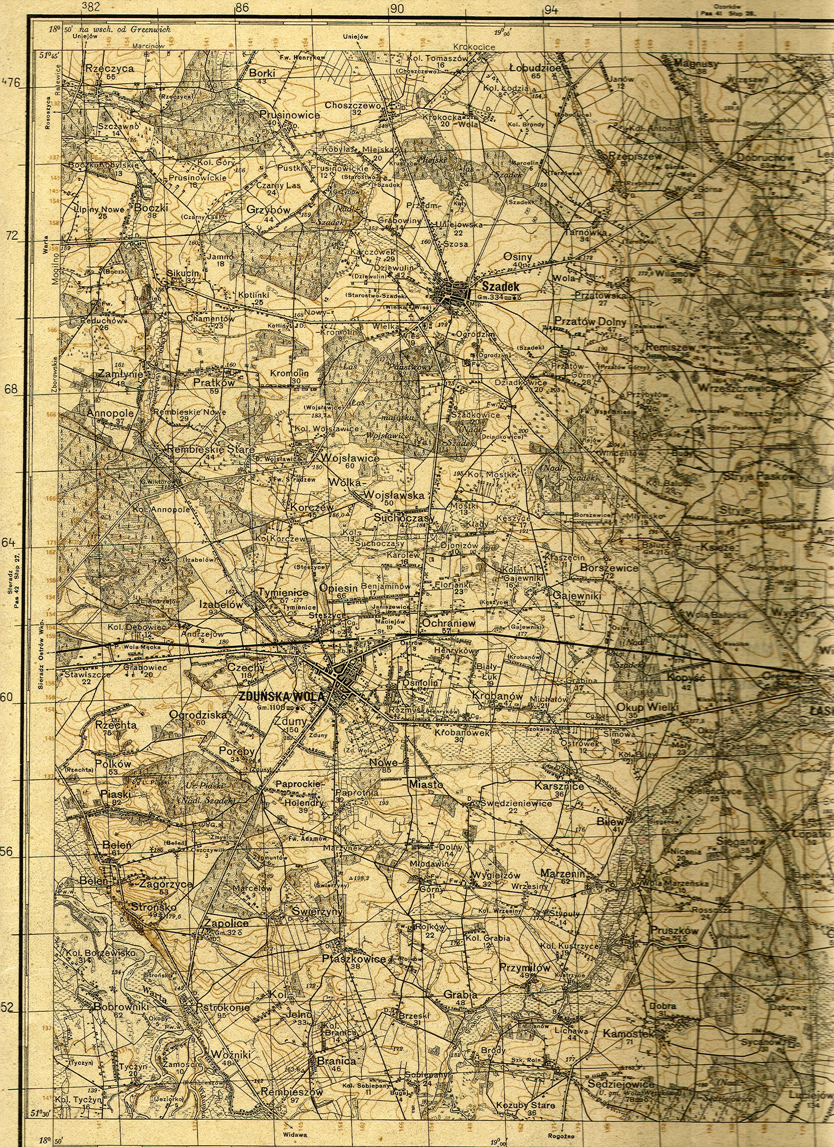
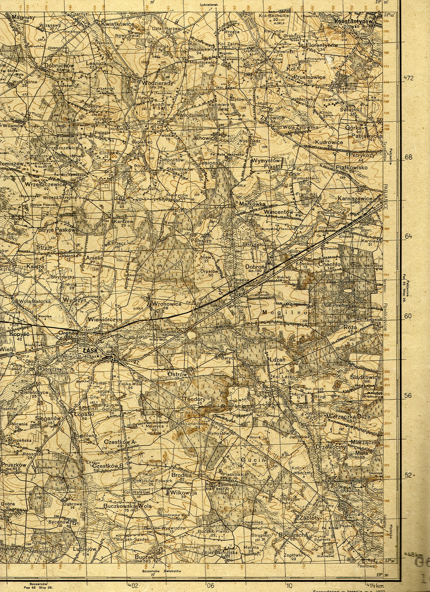
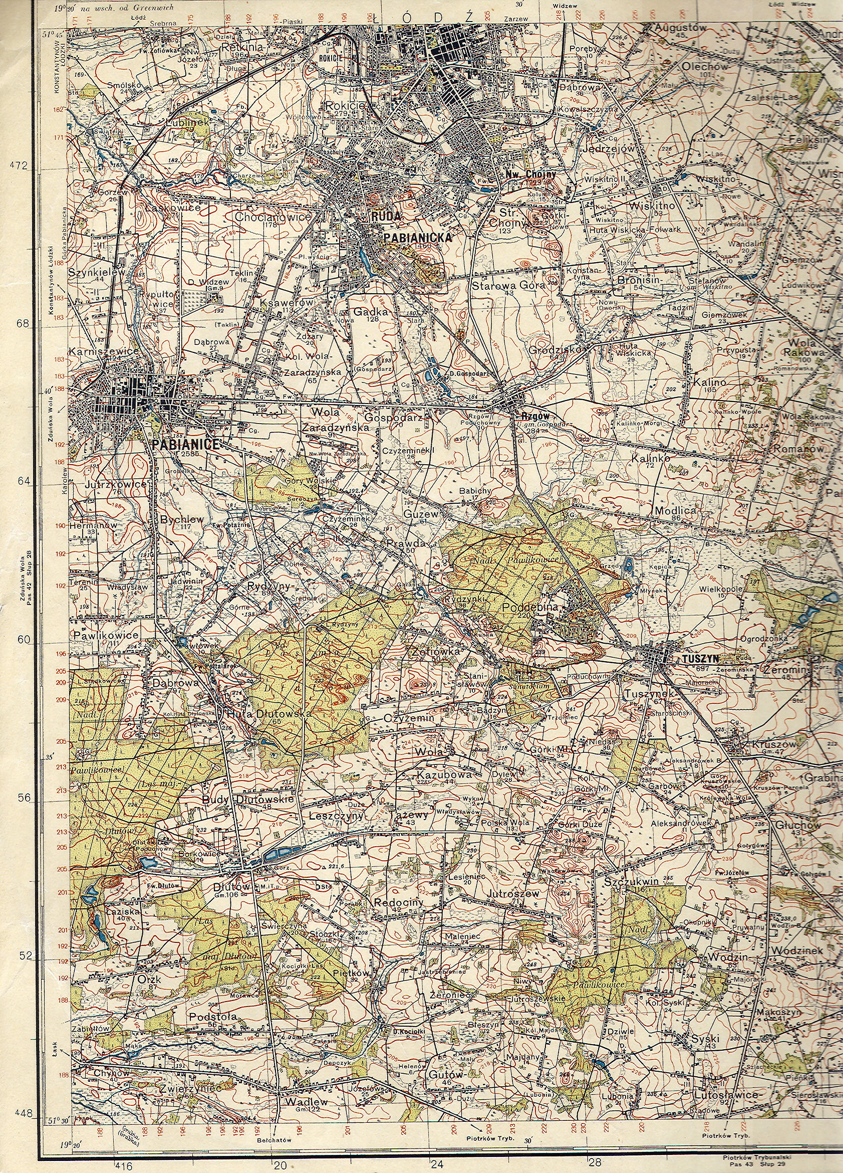
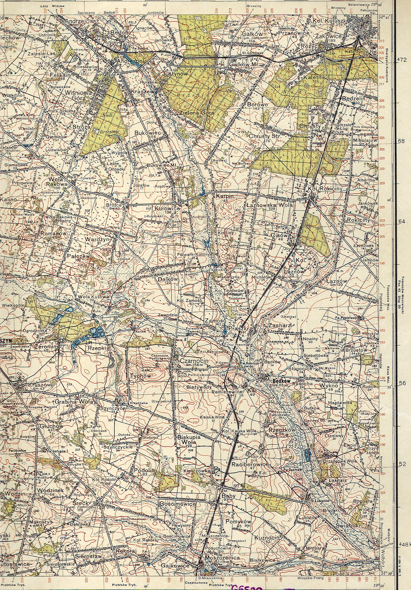
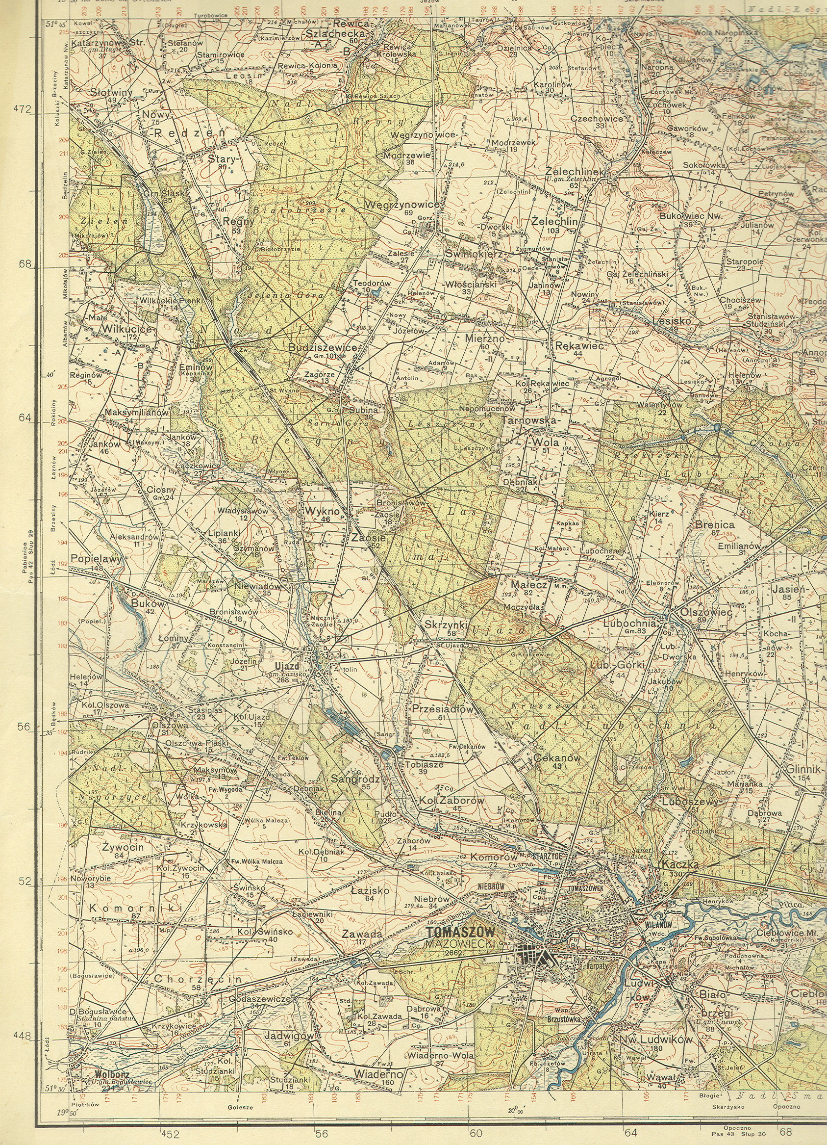
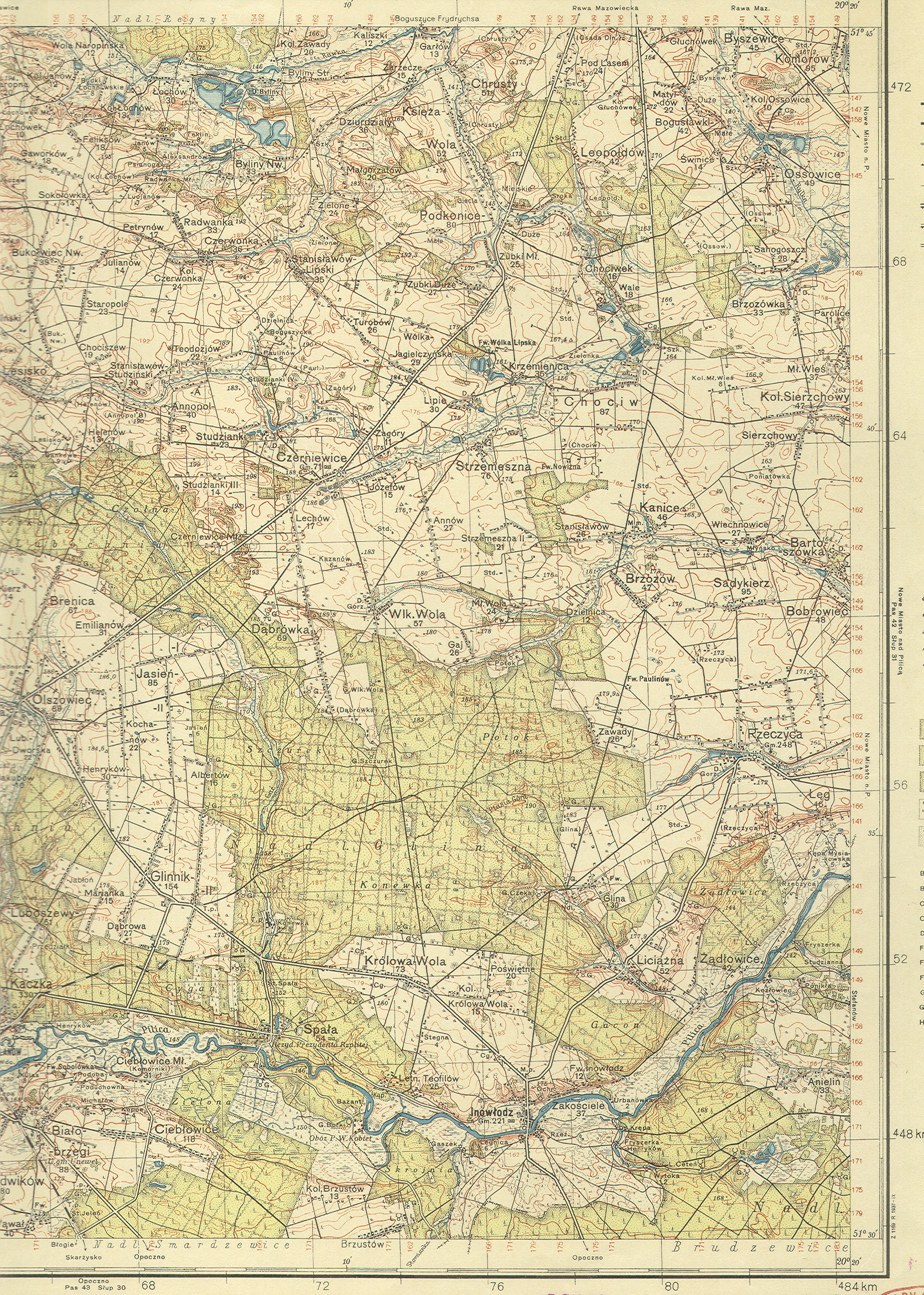
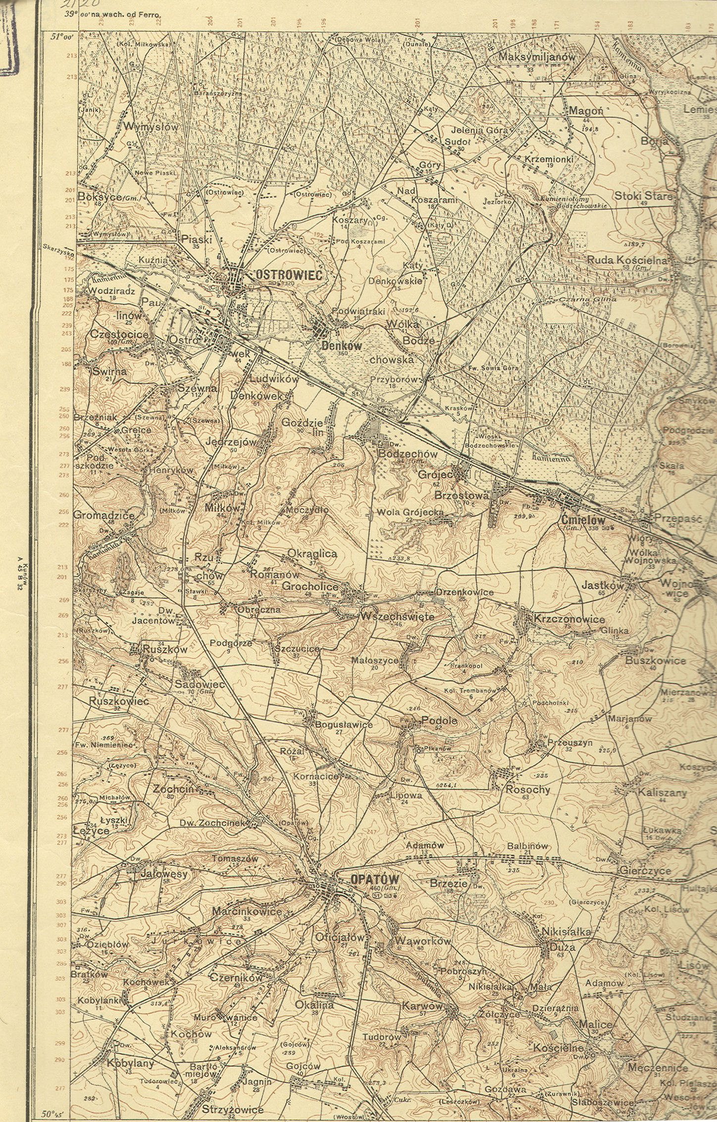
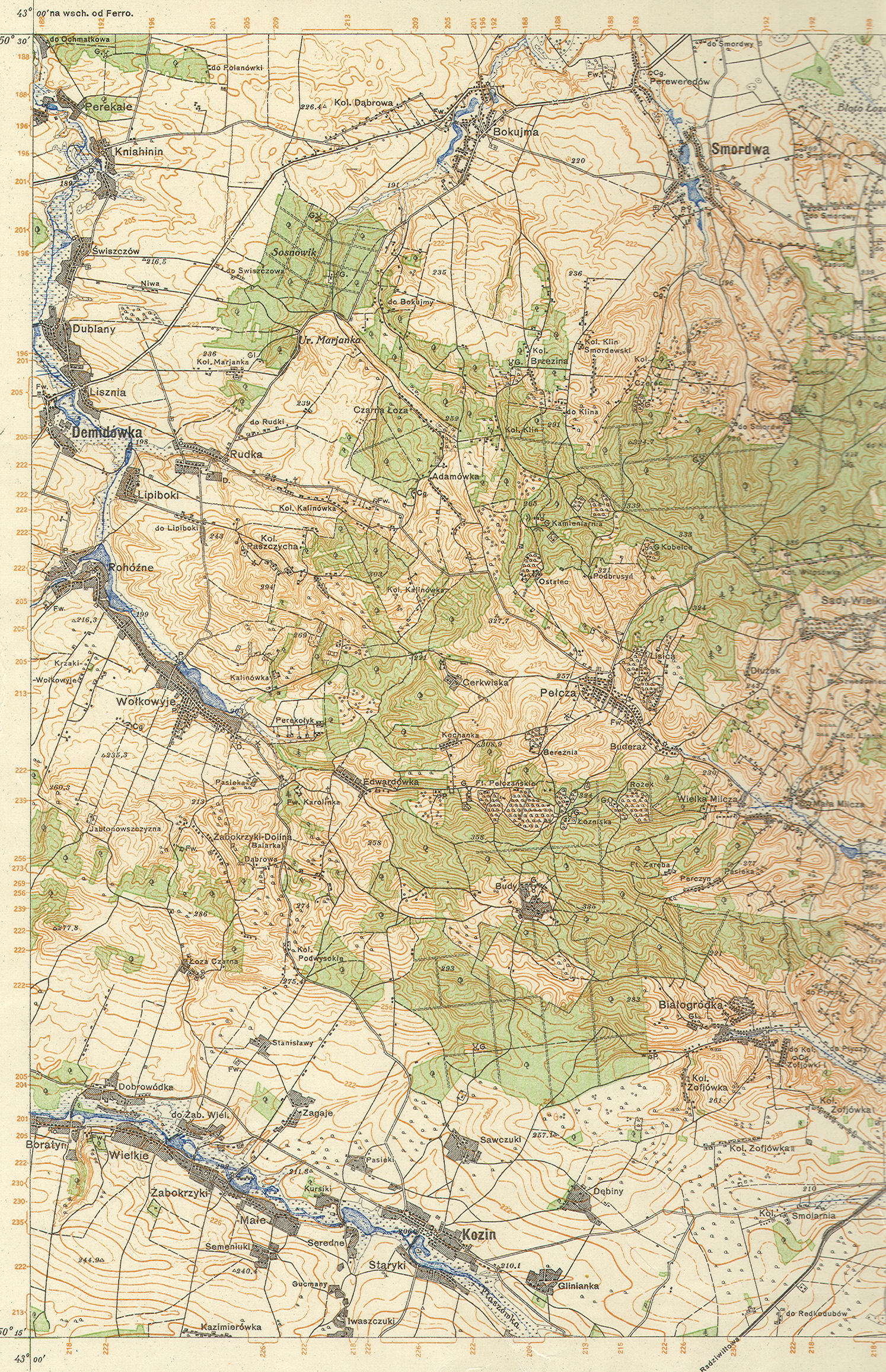
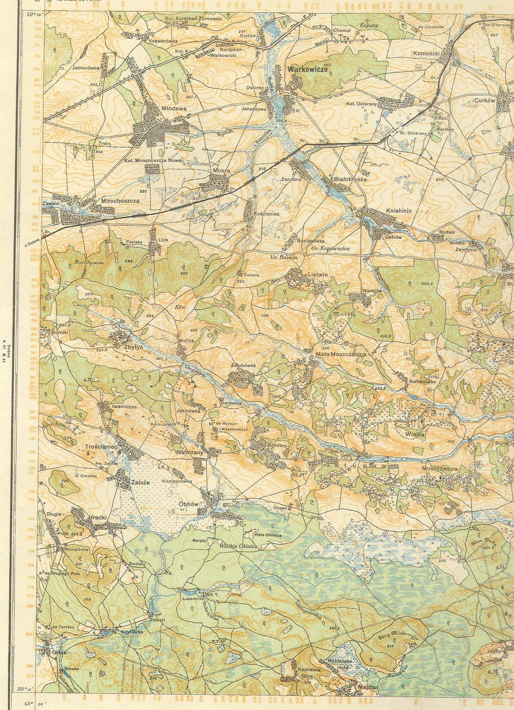
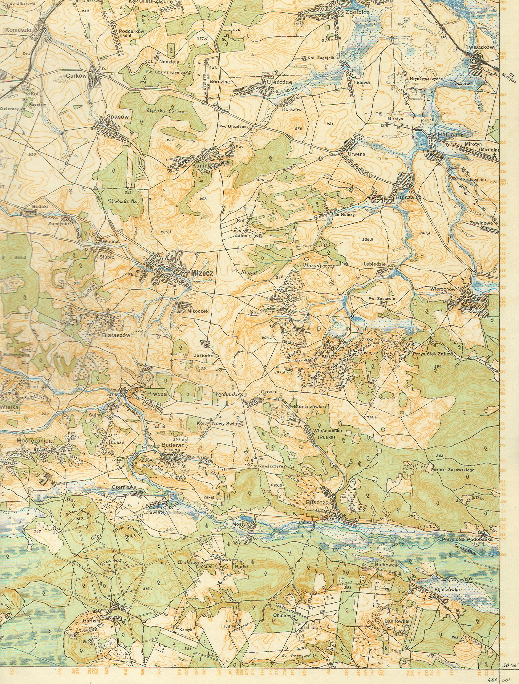
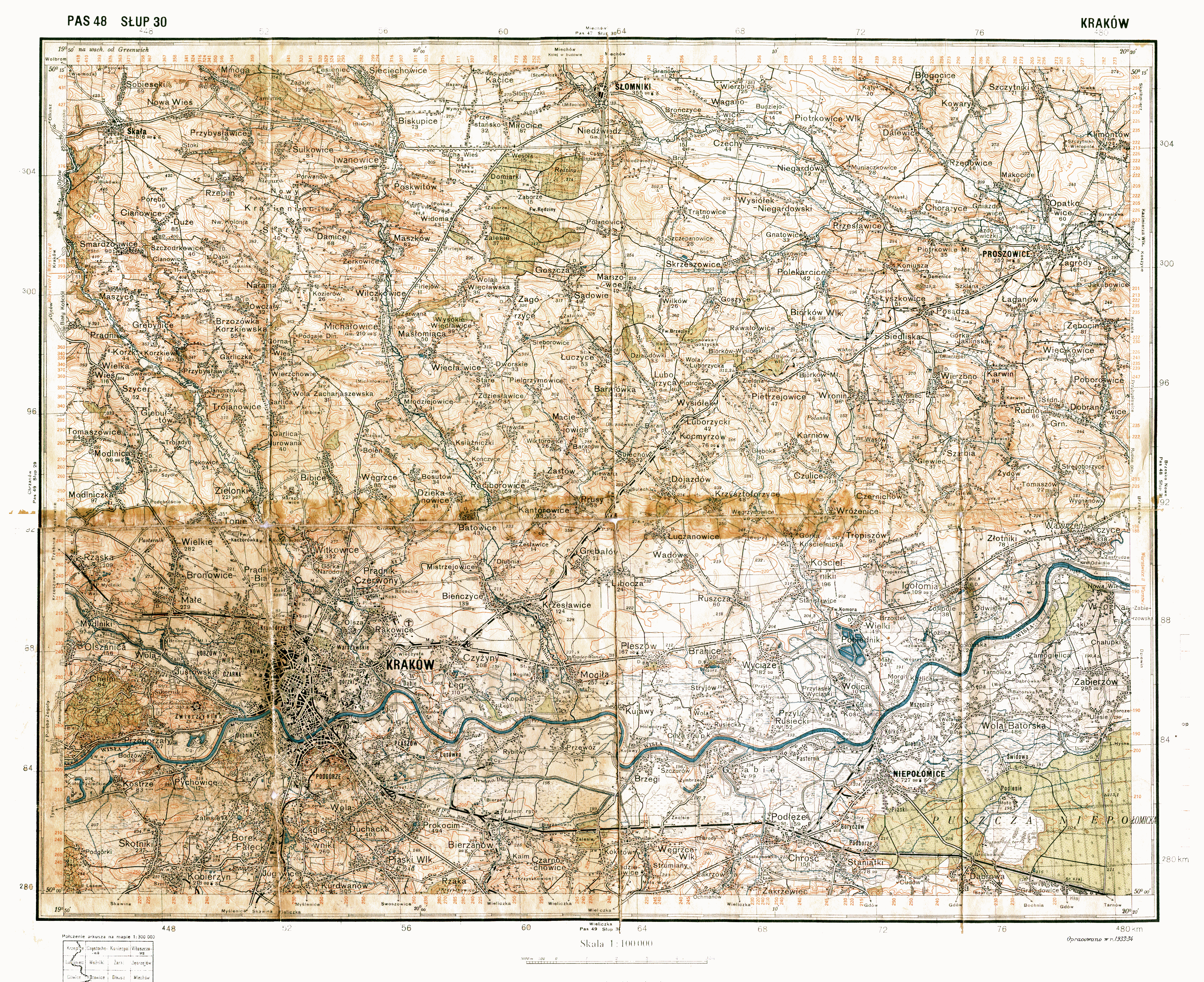
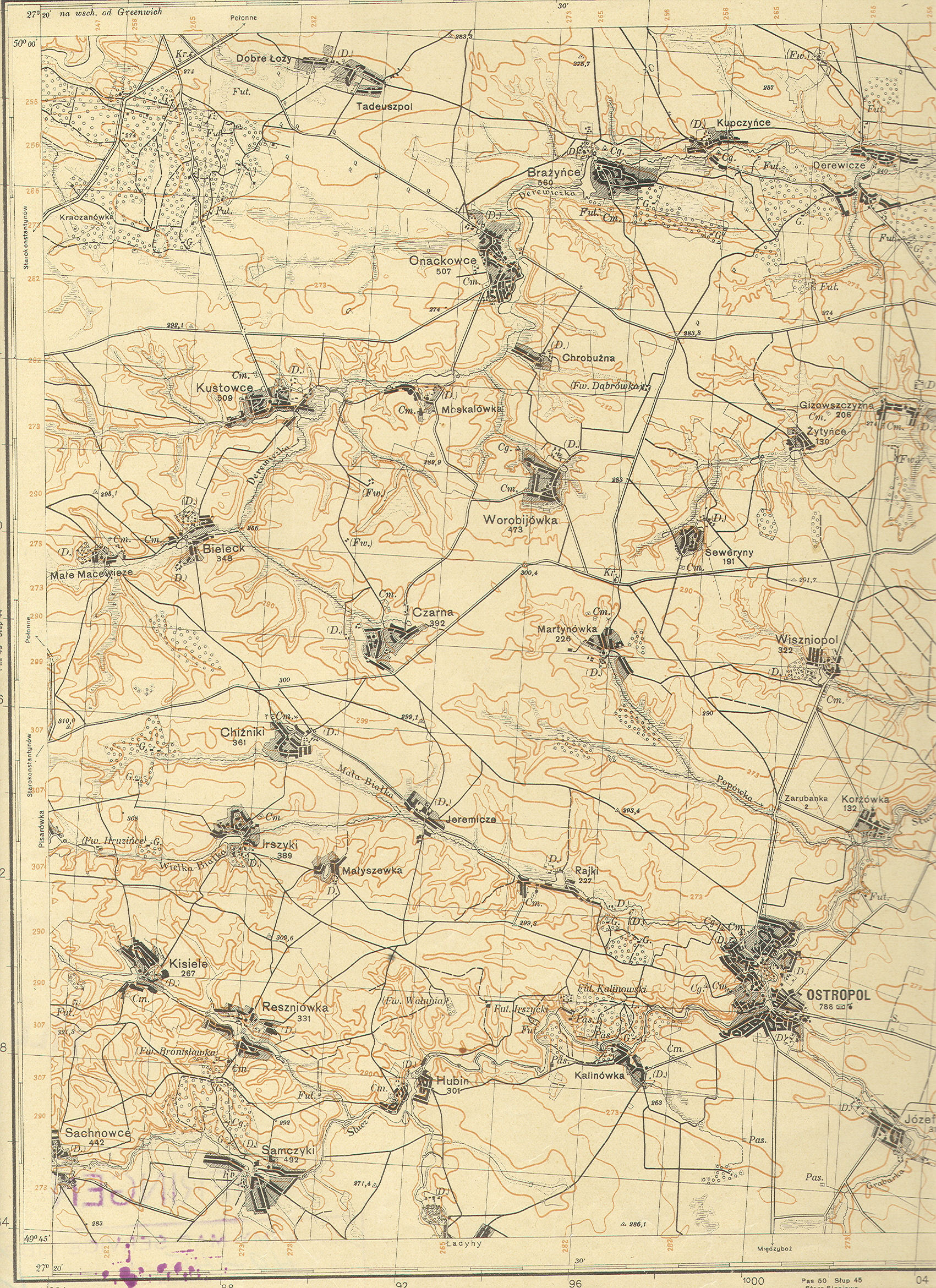
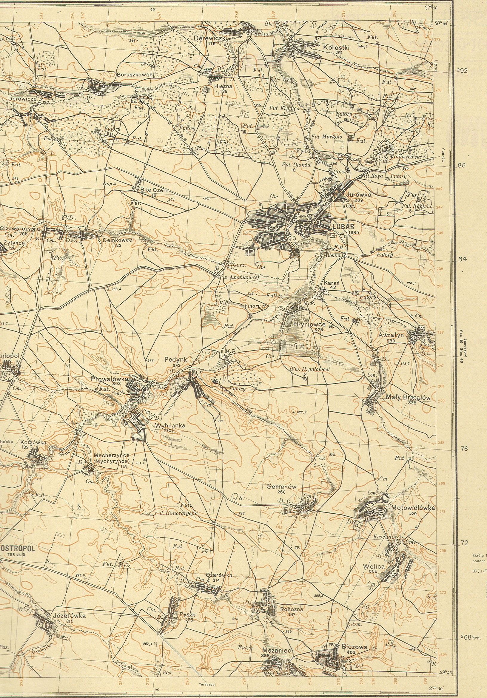
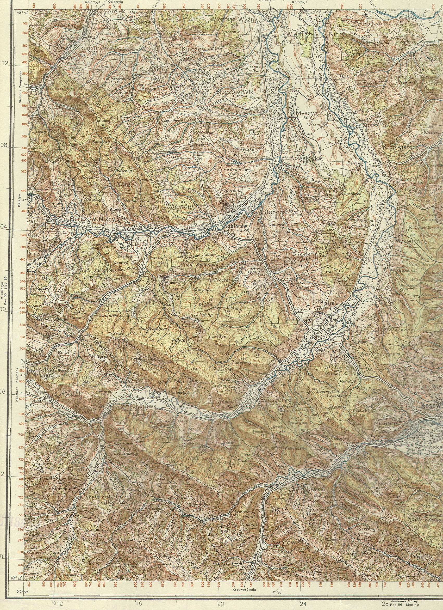
Displayed
on these five web pages are more than one hundred topographic maps of
various regions in Poland, along with some from Belarus and the Ukraine.
Most maps shown have been divided into
a right half and left half. All of the maps were drawn and produced between
World Wars I and II. It is interesting to note the names of the various
towns and villages in the surrounding areas as they appeared before World
War II, as well as of course the varying topography within each region. The
range of coordinates are given for each map, or rather for each two maps
shown, as most of the maps shown are split into two halves.
Instructions for optimal
viewing: Left-click onto any of the map images below and a larger
version will appear on your screen. To see the map in all its glorious
detail, be sure to circle your mouse arrow around the bottom right corner of
the larger image until the gold "expand to regular size" icon with
four arrows appear. You might have to left-click on the bottom right corner
of the image for the icon to appear. Once you have found the icon,
left-click on that to see the full image. Enjoy!